New maps and data released by the Manitoba government have shed more light on where COVID-19 has showed up in the province. Gone is the official map that showed only the province's five health regions - instead, the map has been broken up by health districts, breaking the province into 71 pieces.
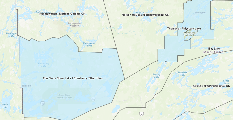
The maps, visible on Manitoba's provincial COVID-19 dashboard, split each health region up into smaller areas to better show where individual cases of the disease have been located. For example, the Northern Health Region is split into 15 smaller regions.
Data on the locations of cases has also been made available on the dashboard, including where there are active cases of COVID-19 and how many cases have been reported in each region and district during the pandemic. For example, as of August 13, active cases of COVID-19 are present in several health districts, including in Arborg-Riverton, Beausejour, Gimli, Pinawa-Lac du Bonnet, Stonewall/Teulon, Springfield and another unknown district, within the Interlake-Eastern Regional Health Authority.
According to the map, most of the active COVID-19 cases in Manitoba have been focused around Brandon, Winnipeg and communities near Winnipeg. Brandon currently has 80 cases of COVID-19, while 32 people within Winnipeg are ill with the disease. In the RM of Springfield east of Winnipeg, 28 people have COVID-19, with another 11 in the Cartier/St. Francois Xavier district north of Winnipeg. Eight cases are active in Steinbach and another six people in Portage la Prairie have COVID-19.
The new data also confirms the location of the three COVID-19 cases found early in the pandemic within the Northern Health Region - one in the Flin Flon/Snow Lake/Cranberry Portage/Sherridon district and two in the Thompson/Mystery Lake district.
The map can be accessed at manitoba.ca/covid19.


